Every New Zealand trail, in your pocket.
LINZ topo, vector and aerial maps. DOC huts, tracks and alerts. Mountain weather and whole-island offline packs — the map that keeps working where the signal doesn't.

Scan to download
Point your phone camera here
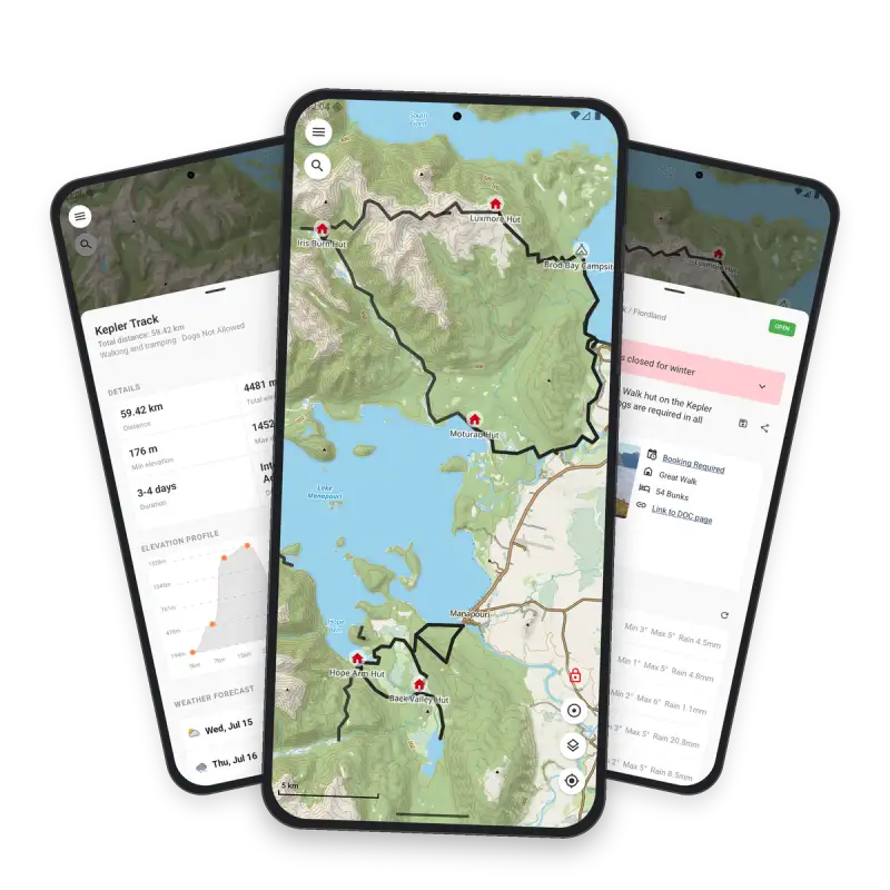
Built for New Zealand, tuned for no signal.
One app for planning at home and navigating on the ridge — with the data sources trampers actually trust.
Download once, hike offline
Grab North or South Island raster packs or the full NZ vector pack, then navigate with zero coverage — fonts and labels included.
Topo, vector or aerial
Switch LINZ basemaps instantly and overlay DOC huts, tracks, hillshade and conservation land — your map, your way.
Mountain weather
Hour-by-hour temperature, wind and rain for ~60 ranges, parks and peaks — straight from the met.no service.
DOC huts & alerts
Live hut, campsite and track data from the official DOC API — facilities, bunk counts and closure alerts before you go.
Plan with real trail data
Distance, elevation gain and difficulty up front, plus elevation profiles and plain-language AI track summaries.
Satellite safety check-ins
Share a time-limited beacon link so contacts can watch your location — even over One NZ / Spark satellite data.
A closer look at the app.
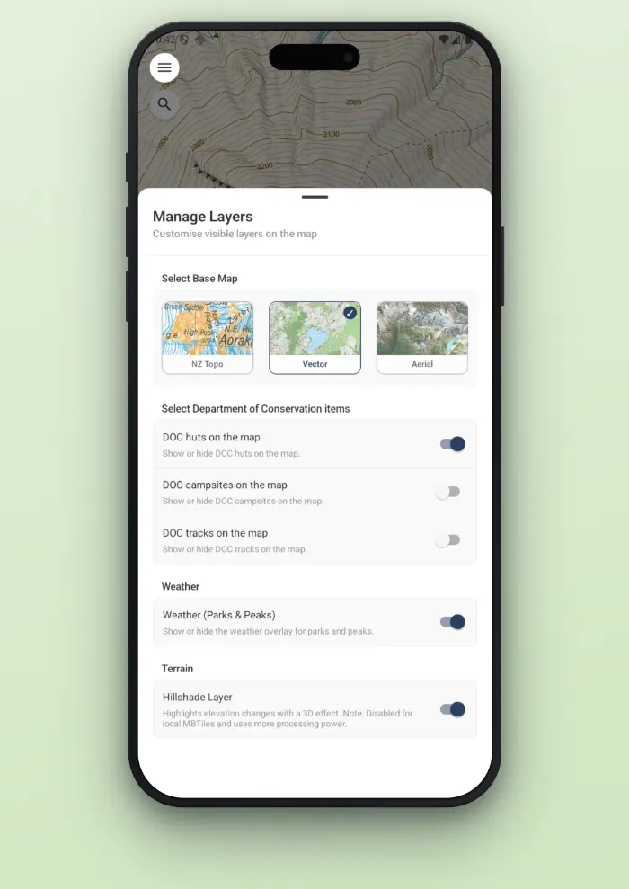
Switch base maps and DOC overlays
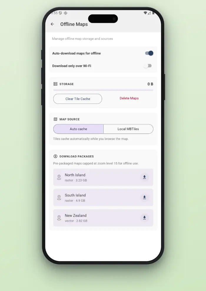
Whole-island downloads
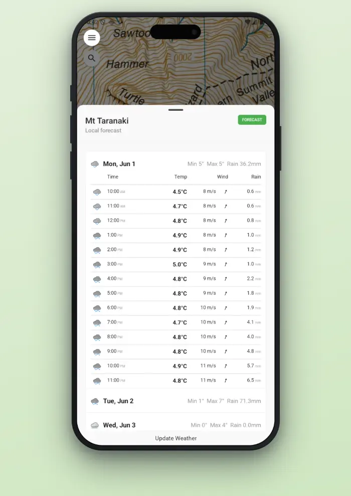
Temp, wind and rain
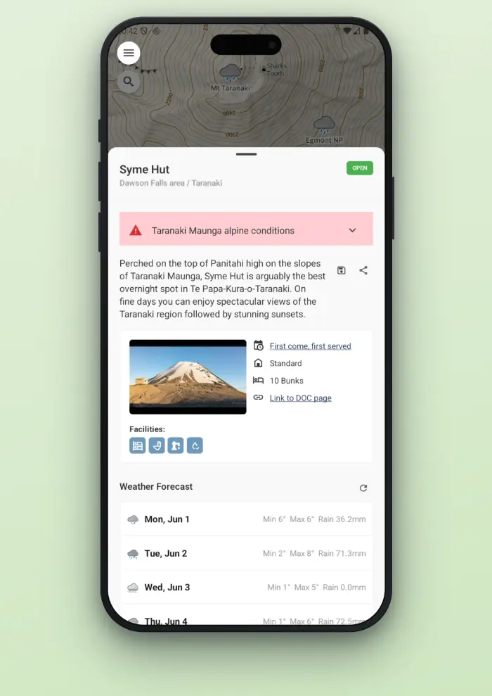
Facilities, bunks and alerts
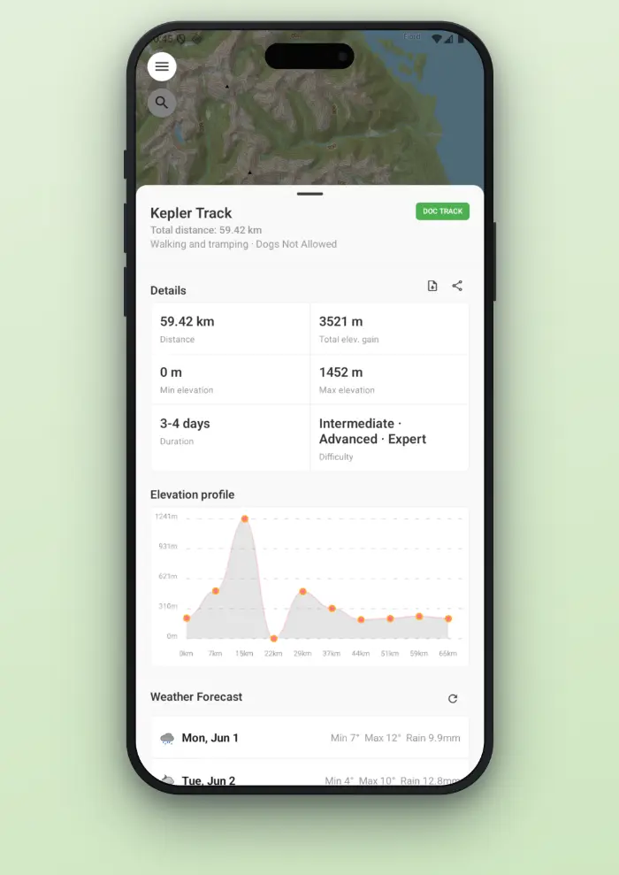
Distance, elevation, difficulty
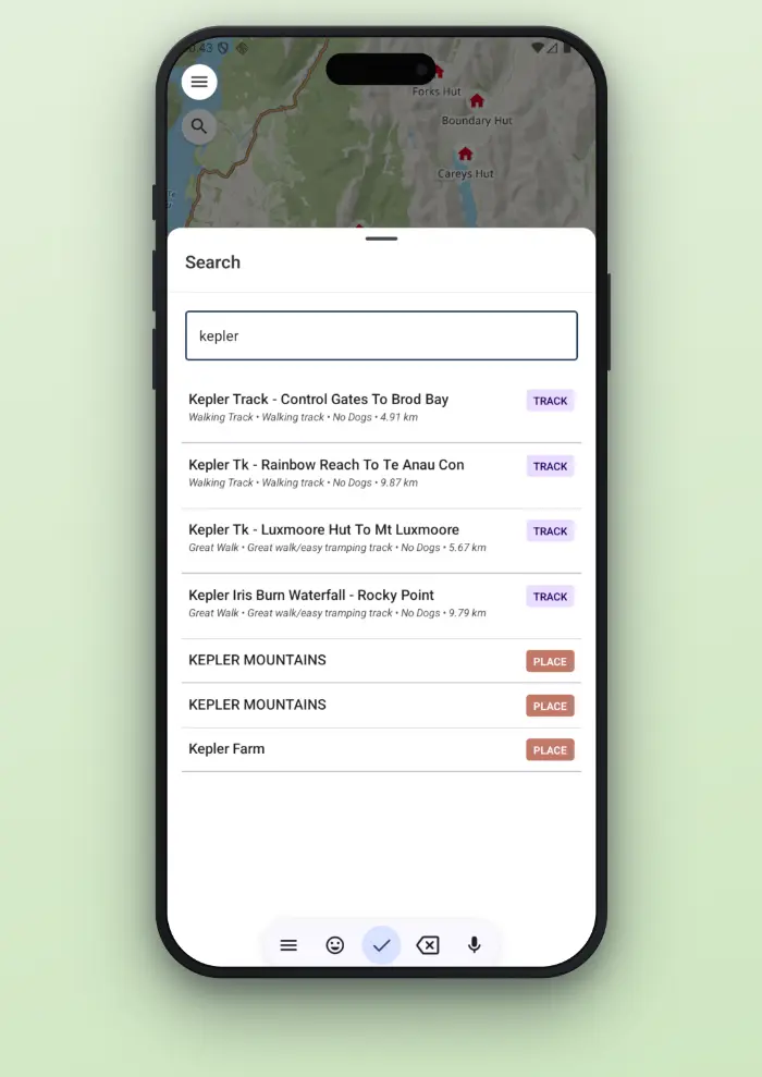
Great Walks, huts and places
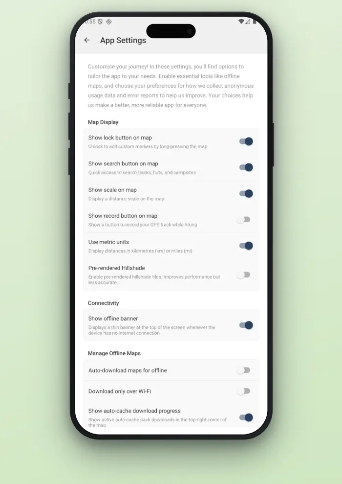
Tools, units and controls
Walk Te Araroa, one section at a time.
Follow New Zealand's long trail from Cape Reinga to Bluff, or the other way. Te Araroa is free for everyone and is not part of PLUS.
Every official section
All of the Te Araroa Trust's official sections, by region, on one screen and on the map.
Tick off your progress
Tick off sections as you walk them and see how far you have come in km and as a percentage, north to south or south to north.
Offline topo maps per section
Download the topo maps for a section before you go, so the map works with no signal.
GPX export per section
Export any section as a GPX file to use in another app or device.
Walk this section
A map mode that shows the km left to the end of the section, or how far you are off the route. You mark a section completed yourself, never automatically.
Te Araroa trail data © Te Araroa Trust, CC BY 4.0, teararoa.org.nz
TrailTreks is not affiliated with the Te Araroa Trust.
Not a safety tool. Carry a PLB and check the official trail notes and alerts.
Your Te Araroa progress stays on your device. See the Privacy Policy.
The core app is free, and always will be.
Offline maps, DOC data, weather, tracks, markers, search and beaconing are free for everyone without any ads. PLUS is an optional subscription that adds a few extras on top.
Unlimited alerts
The free plan includes 3 DOC alert watches and 3 weather alert regions. PLUS removes both limits.
Offline hillshade
Terrain shading on your map with no signal. Download hillshade for offline map packs.
Offline experimental layers
Download overlay layers for offline map packs: public conservation land, recreational hunting areas, paper roads and bike tracks. The layers stay free to view online.
Dark vector map
A dark recolour of the vector base map, easier on the eyes at night.
High contrast vector map
A high-contrast recolour of the vector base map, easier to read in bright sunlight.
Snap to track
Draw a route that follows DOC tracks between the points you place. Routed lines are approximate, so check them against the map.
Monthly or yearly plans, priced in the app store.
PLUS is managed and cancelled through the App Store or Google Play.
See the Terms of Use and Privacy Policy.
Everything TrailTreks: NZ Topo Maps can do.
View full feature listShow less
Maps & Basemaps
- Four switchable basemaps: LINZ topo (raster), LINZ vector topographic, LINZ aerial imagery, and offline mbtiles
- "Raster Look" toggle applies the classic printed NZ topo colour palette on top of any vector-rendered map
- Overlay layers: public conservation land, recreational hunting areas, hillshade, scree, native bush, scrub, paper roads
- Live compass and "follow me" location puck with heading/course tracking
Offline Maps
- Auto-cache mode — tiles download automatically as you pan/zoom, with a Wi-Fi-only option and live download progress
- Pre-packaged downloadable regions: North Island (~3.2 GB), South Island (~4.9 GB) raster packs, or a full NZ vector pack (~2.8 GB)
- Import your own custom .mbtiles file
- Fully offline rendering, including fonts and labels, once downloaded — no signal needed on the trail
- Offline packs for hillshade and overlay layers are part of PLUS (see below)
DOC Data (Huts, Campsites, Tracks, Alerts)
- Live Department of Conservation hut, campsite and track data straight from the official DOC API
- Facility icons, activity info and detail sheets for every hut/campsite
- DOC alerts (closures, hazards) shown distinctly from "couldn't check" states
- Curated tracks supplementing DOC's own listings
Search
- One search bar that looks across everything at once: DOC huts, campsites and tracks, LINZ place names and features, and Topo50 map sheet names
- Search your own saved tracks and markers by name/description
- Paste in a latitude/longitude or NZTM coordinate and the map jumps straight there
- Recent searches saved for quick re-use
Track Recording
- Background GPS recording that survives app kill, backgrounding and device reboot
- Three accuracy modes (Super Accurate / Optimised / Low Accuracy) trading battery for precision
- Pause/resume recording with a live on-map trace
- Persistent recording notification and automatic crash recovery of in-progress sessions
Manual Track Creation
- Draw a route by hand on the map using a crosshair/reticle (pan-and-tap), up to 200 points
- Drag and reposition individual points after placing them
- Live distance readout while drawing
GPX Import/Export & File Handling
- Open any .gpx file from email, Files, Drive etc. directly into the app
- Automatic duplicate-track detection on import
- GPX waypoints auto-convert into colour-coded map markers (huts, campsites, summits, parking, water sources)
Elevation & AI Track Summaries
- Elevation profile for every track, with an NZ-specific 8m-resolution LINZ DEM fallback for full national coverage
- AI-generated plain-language track descriptions covering difficulty, terrain and NZ context
- On-demand elevation refresh for hand-drawn tracks
Weather
- On-demand forecasts for around 60 NZ ranges, parks and peaks via the official Norwegian met.no service
- Per-hut/campsite/track weather lookups, with a longer 10-day window for tracks
- Map weather overlay with temperature, symbol and rain-probability icons
User Markers & Favourites
- Drop custom pins anywhere on the map (long-press), in four colours
- Bookmark any DOC hut/campsite as a personal marker linked back to its DOC listing
- Full marker management: edit, delete, show/hide on map, bulk delete, save to cloud
- Coordinates shown in both WGS84 and NZTM (NZ Transverse Mercator)
User Tracks
- Central "my tracks" library holding recorded, GPX-imported, hand-drawn and DOC-saved tracks side by side
- Full tracks management: edit, delete, show/hide on map, bulk delete, save to cloud
Cloud Backup & Restore (Tracks & Markers)
- Save any individual track or marker to the cloud via its menu — "Save to Cloud" — tied to your signed-in account
- "Fetch from Cloud" button on the Tracks and Markers screens shows how many items you've backed up and pulls down anything not already on the device
- Handy for restoring your own tracks/markers after switching phones or reinstalling — sign in with the same account, then fetch
- Manual, per-item opt-in backup (not automatic background sync) with duplicate detection on fetch
Sharing & Deep Linking
- Share any track, DOC hut/campsite, or personal marker via a short trailtreks.nz link
- Recipients open the link straight into the app (or a web view) — no account needed to view
- Smart duplicate detection so shared items aren't imported twice
Location Beaconing (Satellite Safety Check-ins)
- Create a time-limited "beacon session" and share a link so contacts can watch your location without installing anything
- Works over satellite messaging (One NZ/Spark satellite plans) for zero-cell-coverage areas
- Choose session expiry (1–30 days); sessions and points auto-expire from public view
- Framed as a manual check-in tool, not an SOS/emergency service
User Accounts
- Sign in with Google or Apple — no passwords to manage
- Account deletion from Settings, cleanly removing all shared content
Settings & Other
- Layer visibility toggles, offline download preferences, Wi-Fi-only downloads
- About/What's New screen
- Smart "are you enjoying the app" soft-ask shown only to engaged, happy users before the native App Store/Play Store review prompt
Download once.
Hike offline.
Free to download, no account needed to explore. Grab TrailTreks: NZ Topo Maps before your next trip into the New Zealand backcountry.
Scan & Go
Open your camera and point it at the code to install.