Let the people you trust follow your hike.
Location Beaconing lets you post your position to a private, time-limited link while you're on the trail. Your contacts open it in any browser — no app, no account — and see where you last checked in.
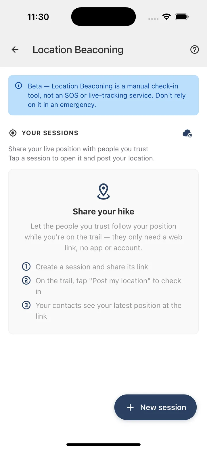
Beta — Location Beaconing is a manual check-in tool, not an SOS or live-tracking service. It can't contact emergency services and nothing is sent automatically. Don't rely on it in an emergency — use your phone's built-in satellite SOS or a distress beacon.
Share your hike in a few taps.
From creating a session to your contacts watching along at home — here's the whole flow, step by step.
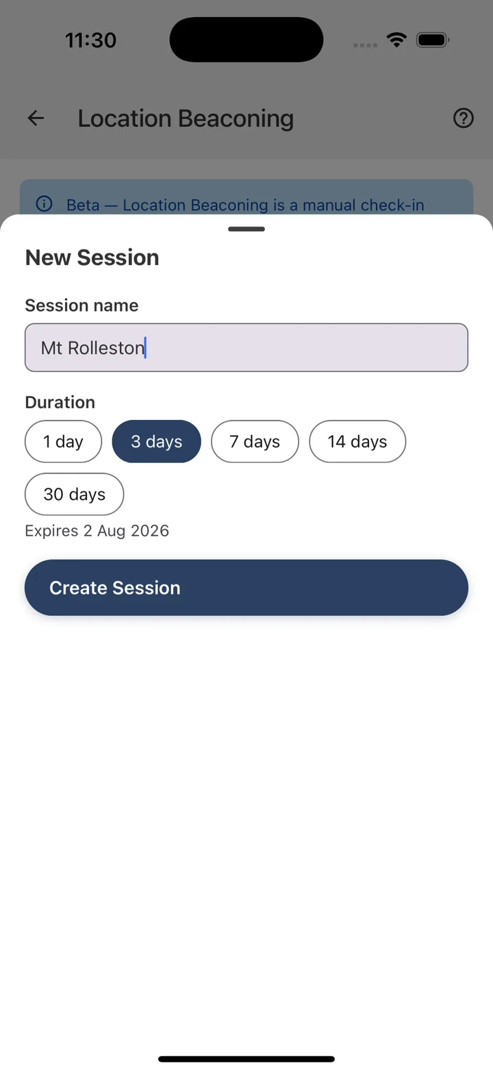
Create a session
Open Location Beaconing and tap New session. Name it after where you're heading, choose how long the link stays active — anywhere from 1 to 30 days — then tap Create Session.
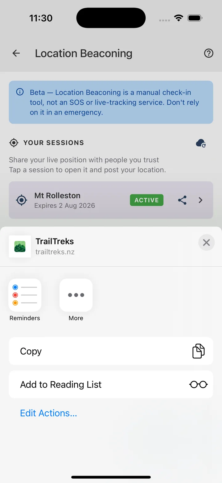
Share the link
TrailTreks generates a private link and opens your share sheet straight away. Send it to whānau or friends by message, email or anything else. They only need a browser — no app, no account.
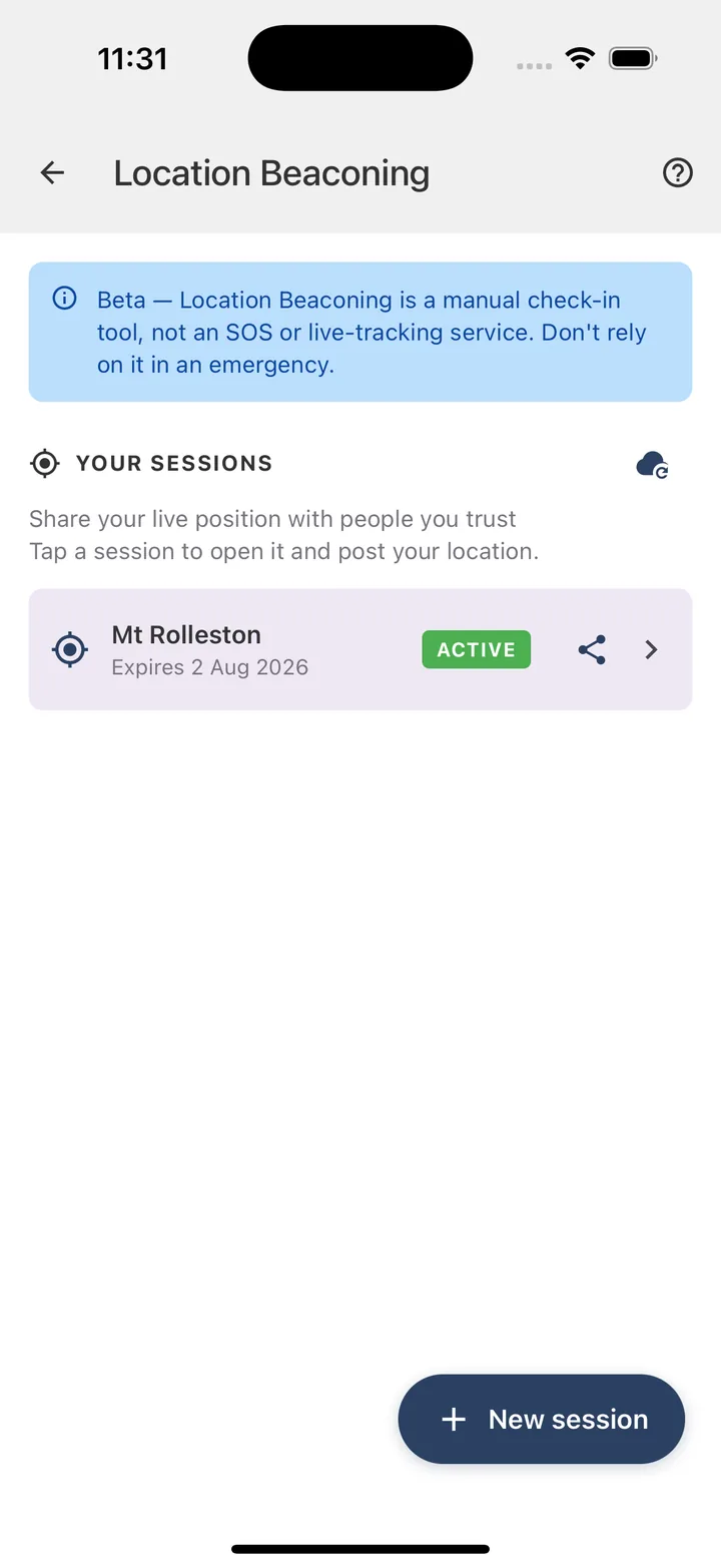
Your sessions in one place
Every session you create is listed with its status and expiry date. Tap one to open it, re-share the link, or post a new location. Sessions stay active until the date you set.
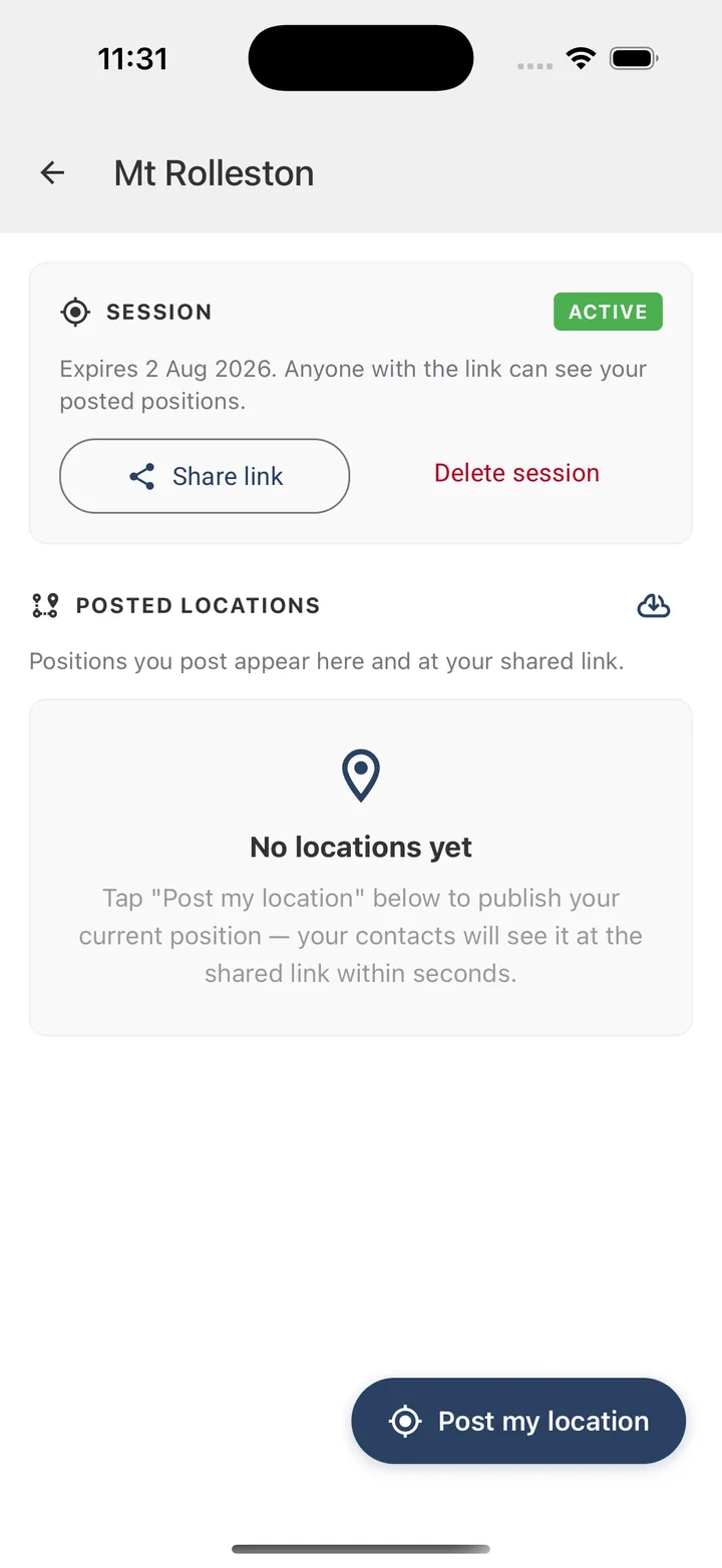
Check in from the trail
At a hut, junction or summit, open your session and tap Post my location. TrailTreks captures a single GPS fix and publishes just that point — small enough to send over One NZ or Spark satellite data.
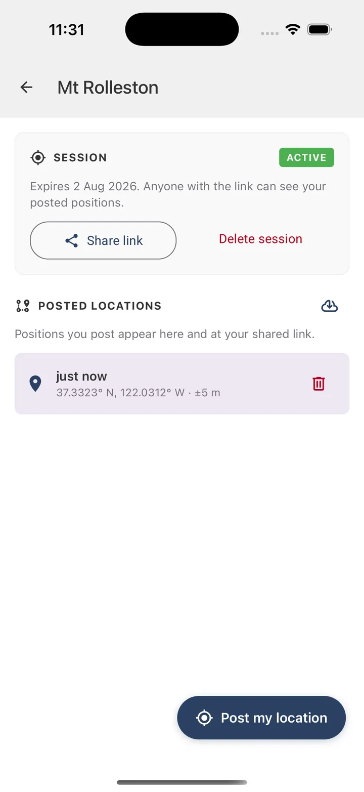
Your check-in is shared
Each check-in appears instantly with the time and GPS accuracy, and updates the shared link within seconds. Post as often — or as rarely — as you like. You're always in control.
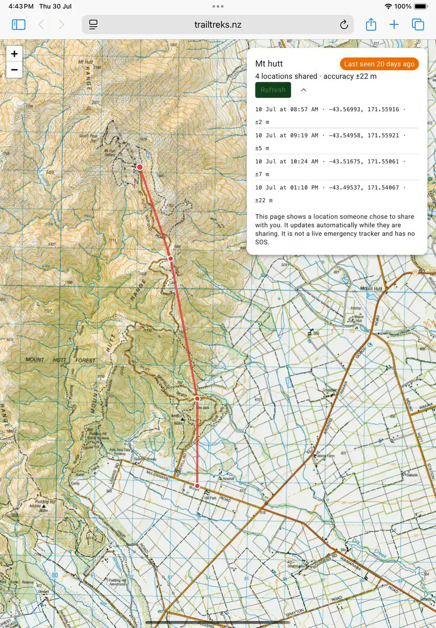
Contacts follow along
At the link, the people you trust see your latest position on a map, along with the trail of earlier check-ins and when you were last seen. It updates automatically while you're sharing, and when the session reaches its expiry date the link stops working.
What Location Beaconing is — and isn't.
A manual check-in tool for peace of mind on the trail, with a few things worth understanding before you rely on it.
You're always in control
Nothing is ever sent automatically. Your position is only published the moment you tap Post my location.
Built for satellite
Each check-in is tiny, so it can travel over One NZ or Spark satellite data on recent phones. On mobile or Wi-Fi it works on any supported device.
No app for your contacts
Anyone you send the link to can follow along in a normal browser. There's nothing for them to install and no account to create.
Time-limited by design
You set an expiry between 1 and 30 days. Once it passes, the link stops working and your posted positions are no longer viewable.
Only share with people you trust
Anyone who has the link can view the session, so keep it to the people who need it. You can delete a session — and its link — at any time.
Not an emergency SOS
Beaconing can't contact emergency services. For a real emergency, use your phone's built-in satellite SOS or a dedicated distress beacon.
Download once.
Hike offline.
Free to download, no account needed to explore. Grab TrailTreks: NZ Topo Maps before your next trip into the New Zealand backcountry.

Scan & Go
Open your camera and point it at the code to install.